×
  • Kathmandu, Nepal
  • +9779863201248

Mountain Mate

Pisang Peak

Duration
14 days
Altitude
Group
Grade
Accomodation

Overview

 ABOUT TRIP 
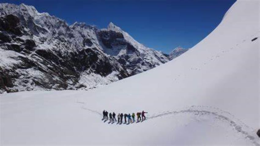
"Pisang Peak" is a Himalayan peak located in the Annapurna region of Nepal. It is one of the popular trekking peaks in Nepal, reaching an elevation of 6,091 meters (19,980 feet). Pisang Peak offers stunning views of the Annapurna mountain range and the surrounding landscapes.

Climbing Pisang Peak requires mountaineering skills and it is generally done as part of the Annapurna Circuit Trek. Trekkers need to obtain a climbing permit from the Nepal Mountaineering Association to climb Pisang Peak. It is recommended to have pre experience in basic mountaineering techniques before attempting to climb Pisang Peak. The entire Annapurna region is well-known for its natural beauty, diverse landscapes, and rich cultural heritage. It attracts thousands of trekkers and climbers from around the world every year.

Pisang Peak is a popular trekking and climbing destination in the Annapurna region of Nepal. It's known for its stunning views and relatively accessible climbing routes, making it a great choice for trekkers and climbers looking to experience high-altitude climbing without the extreme challenges of some other peaks.

Key Information About Pisang Peak:

1. Location:
1)Pisang Peak is situated at the Annapurna region of Nepal, part of the Annapurna Conservation Area.
2)It is located between the Annapurna and Manang valleys.

2. Height:
1)The peak stands at approximately 6,091 meters (20,013 feet) above sea level.

3. Climbing Difficulty:
1)Pisang Peak is considered a trekking peak, meaning it is accessible to climbers with moderate experience.
2)The route involves snow and ice climbing, but it is less technical compared to other high-altitude peaks.
3)Some experience with high-altitude climbing and basic mountaineering skills is advisable.

4. Best Time to Climb:
1)The best times to climb Pisang Peak are during the pre-monsoon (March to May) and post-monsoon (September to November) seasons.
2)During these periods, the weather is generally stable, and the conditions are more favorable for climbing.

5. Trekking Route:
1)The typical itinerary for Pisang Peak involves a combination of trekking and climbing.
2)The trek usually starts from Kathmandu and involves reaching the Annapurna region via a drive or flight to Pokhara and then continuing by trek to Pisang.
3)From Pisang village, climbers will head towards the base camp, then to high camp, and finally summit the peak.

6. Permits and Fees:
1)Climbers need a climbing permit for Pisang Peak, which is issued by the Nepal Mountaineering Association (NMA).
2)In addition to the climbing permit, you will need a TIMS (Trekkers' Information Management System) card and possibly a national park entry permit for the Annapurna Conservation Area.

7. Preparation and Safety:
1)Acclimatization is crucial due to the high altitude. It's important to allow time for your body to adjust to the reduced oxygen levels.
2)Hiring a guide and/or a porter is recommended, not only for assistance with logistics and safety but also for a more enriching experience.

8. Gear and Equipment:
1)Essential climbing gear includes crampons, ice axes, ropes, harnesses, and appropriate clothing for cold weather.
2)It's also important to bring high-altitude trekking gear, including a good quality sleeping bag, layers of clothing, and other personal equipment.

9. Scenic Views:
1)The summit offers panoramic views of the Annapurna range, including Annapurna II, Annapurna IV, Gangapurna, and the Dhaulagiri range.
2)The trek to the base camp and the climb itself provide breathtaking vistas of the surrounding mountains and valleys.

10. Cultural Experience:
1)The Annapurna region is rich in cultural diversity, with opportunities to experience the traditions and lifestyle of local Tibetan-influenced communities, particularly in places like Manang.

Planning a trip to Pisang Peak involves careful preparation, but it can be a rewarding adventure with the right approach and support. If you're considering this climb, make sure to consult with a reputable trekking agency and take all necessary precautions to ensure a safe and enjoyable experience.

Itinerary of Pisang Peak:


Day 01: Drive From Kathmandu to Bulbule -(6-7 hours) 840meters/2,756 feet

Day 02: Trek From Bulbule to Chamje - (5-6hours) 1,430 meters/4,690 feet

Day 03: Trek From Chamje to Dharapani - (5-6 hours) 1,950 meters/6,396 feet

Day 04: Trek From Dharapani to Chame-(5-6hours) 2,630m/8,628ft

Day 05: Trek From Chame to Upper Pisang-(5-6hours) 3,700m/12,136ft

Day 06: Acclimatization Day At Upper Pisang -3,700m/12,136ft

Day 07: Trek from Upper Pisang to Pisang Peak Base Camp - (3-4hours) 4,380m/14,370ft

Day 08: Trek to Pisang Peak High Camp - (3-4 hours) 5,400 meters/17,712 feet

Day 09: Summit to the Peak and Back to Base Camp -(7-9 hours) 6,091 meters/19,980 feet

Day 10: Trek From Pisang Peak Base Camp to Manang Valley - (5-6 hours) 3,450 meters/11,316 feet

Day 11: Trek From Manang to Yak Kharka - (3-4 hours) 4,110 meters/13,480 feet

Day 12: Trek From Yak Kharka to Thorong Pedi -(3-4hours) 4,600 meters/15,092 feet

Day 13: Cross Thorong La in the Morning and Trek to Muktinath - ( 8-10 hours) 3,710 meters/12,171 feet

Day 14: Trek From Muktinath to Tatopani  - (1190 meters/3,904 feet)6-7 hours

Day 15: Drive From Tatopani to Pokhara - (5-6 hours) 822 meters/2,696 feet

 Included in the Cost (Inclusive) 

  •  ®  Pick up and drop services to the airport.
  •  ®  Round trip heli ride.
  •  ®  All relevant fees, taxes, and levies. 
  •  ®  A complete full set breakfast/lunch in Gorakshep or in Everest view point
  •  ®  Down jacket, hat, gloves (return after use)
  •  ®   Experience certificate (after completion the journey)

 Not Included In the Cost (Exclusive)  

  •  ©   Individual  Gears and Equipments.
  •  ©   Trekking Costs like Drinking Water, Soft & Hard Drinks, Juice, Phone Calls, Web Utilize, Battery Charging, Clothing, Hot Shower, Gift, Extra Porters etc
  •  ©   Any Kinds of Health or Travel Insurance (It is obligatory to decrease the conceivable cost in case of crisis clearing)
  •  ©  Cost emerges due to hindrance and delays within the program schedule due to climate issues or Health problem issues.
  •  ©   Tipping to trekking crew members (highly expected), and Donating.
  •  ©   Any additional expenditures or activities aside from  "Service Provided"

Itinerary

 SHORT ITINERARY 

Day 01: Drive by car from Kathmandu to Besisahar (760m/2,4936ft), Driving Distance: 175km, Duration- 6 to 7 hours.

Day 02: Drive from Besisahar to Dharapani (1,860m/6,102ft), Driving Distance: 356km, Duration- 5 to 6 hours.

Day 03: Walk from Dharapani to Chame (2,670m/8,760ft), Walking Distance: 15km, Duration- 5 to 6 hours.

Day 04: Trekking from Chame to Upper Pisang (3,300m/10,827ft), Walking Distance: 14.5km, Duration- 5 to 6 hours.

Day 05: Upper Pisang Acclimatization Day 

Day 06: Hike from Upper Pisang to Pisang Peak Base Camp (4,380m/14,370ft), Walking Distance: 5 to 7 km, Duration-,3 to 4 hours.

Day 07: Hike from Pisang Peak to High Camp (5,400m/17,716ft), Duration- 3 to 4 hours.

Day 08: Summit to the Peak/Jong Ri (6,091m/19,984ft) and back to Base Camp, Duration- 7 to 9 hours.

Day 09: Hike from Pisang Peak Base Camp to Manang Valley (3,540m/11,614ft), Walking Distance: 15.7km, Duration- 5 to 6 hours.

Day 10: Trek from Manang to Yak Kharka (4,018m/13,182ft), Walking Distance: 10km, Duration- 3 to 4 hours.

Day 11: Walk from Yak Kharka to Thorong Pedi (4,450m/14,600ft), Walking Distance: 7.3km, Duration- 4 to 5 hours.

Day 12: Trek to Muktinath (3,760m/12,336ft) and cross Thorong La Pass (5,416m/17,779ft), Walking Distance: 15km, Duration- 8 to 9 hours.

Day 13: Drive from Muktinath to Tatopani (1,190m/3,904ft), Driving Distance: 481km, Duration- 6 to 7 hours.

Day 14: Drive by car from Tatopani to Pokhara (830m/2,723ft), Driving Distance: 316.7km, Duration- 5 to 6 hours.

Departure Dates

S.No. Start Date End Date Cost Status Book

Gallery

Reviews
All Reviews