×
  • Kathmandu, Nepal
  • 9863201248

Mountain Mate

Manaslu Trek Via Larke Pass

Duration
18 Days
Altitude
5135m
Group
2+
Accomodation
Tea house/Lodges
Grade
Strenuous

Overview

“I learn something every time I go into the mountains.” – Michael Kennedy

 About Trip 
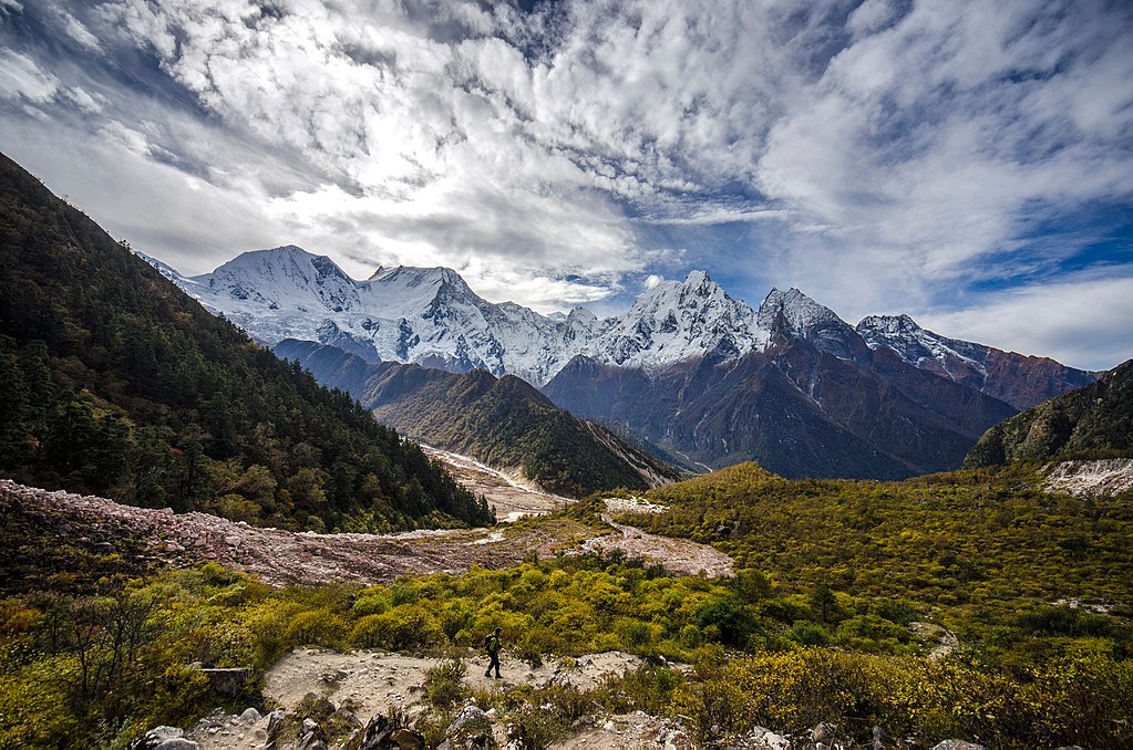
Manaslu 8,163 metres (26,781 ft), also known as Kutang is the eigth highest mountain of the world  above sea level. It is located in the Mansiri Himal part of th Neplease Himalyas, in the west-central part of Nepal Gorkha district and is located about 64 km (40 mi) east of Annapurna . Its name, which means "mountain of the spirit". Manaslu was first climbed on May 9, 1956 by Toshio Imanishi and Gyalzen Norbu, members of a Japanese expedition.The mountain's long ridges and valley glaciers offer feasible approaches from all directions, and culminate in a peak that towers steeply above its surrounding landscape, and is a dominant feature when viewed from distance.

Manaslu trekking route of 177 kilometres (110 mi) skirts the Manaslu massif over the pass down to Annapurna. The Nepalese Government only permitted trekking of this circuit from 1991. The trekking trail follows an ancient salt-trading route along the Burhi Gandaki River.   In view of its favourable topography of long ridges and glacial valleys, Manaslu offers several routes to mountaineers. Important peaks surrounding Manaslu include Ngadi Chuli, Himalchuli and Baudha. A glacial saddle known as Larkya La, with an elevation of 5,106 metres (16,752 ft), lies north of Manaslu. The peak is bounded on the east by the Ganesh Himal and the Burhi Gandaki River gorge, on the west by the deep fissures of the Marysyangdi Khola with its Annapurna range of hills, to the south is the Gorkha town at the foot of the hill (from where trekking operates during the season), which is an aerial distance of 48 kilometres (30 mi) to the peak. 

Manaslu trekking route is a sanctuary to many highly endangered animals, including Snow leopard and Red pandas. Other mammals include lynxAsian black bear, grey wol,fdhole,Assam macque,Himalayn musk deer, blue sheep,Himalayan tahr, mainland serow,Himalayn goral, Wolly horse horshoe bat Himalayn mouse hare and black lipped pika Over 110 species of birds, including Golden eagle,Eurasian griffon,Himalayn griffon,Blood, impeyan, kalij,and koklass phesents Himalayan and Tibeten snow cocks and the crimson horned pheasent, 33 mammals, 11 butterflies and 3 reptiles have been recorded. Conservation of wild life in the area has been achieved by monks of the monasteries in the area by putting a hunting ban in place. This action has helped the wildlife to prosper. The area is now an important habitat for the snow leopard, grey wolf, musk deer, blue sheep and the Himalayan tahr.

There are two ethnicities mainly inhabiting this region, Nubri and Tsum. The branching off of the river at Chhikur divides these two ethnic domains.  In the central hills of the region,Gurungs are the main ethnic group besides this few others Brahmins, cheetris newars also can be found in trail, Closer to Tibet, the Bhutias , akin to the Sherpa group, of Tibetan ethnicity dominate the scene as can be discerned from their flat roofed houses, and they are distinctly Buddhists. The region is dotted with austere  monastries mani walls , chortens and other buddhist religious landmarks.


 Included in the Cost (Received) 

  •  ®    All airport transfers (arrival and departure).
  •  ®   Twin sharing convenience in Kathmandu 
  •  ®   The best local teahouse accommodation during trekking.
  •  ®   Experience leader guide (English speaking, first aid, eco-trained), Sherpa porter (1 porter for 2 trekkers), assistant according to group size.
  •  ®   Breakfast, Dinner, and Lunch are served with seasonal fruits and tea cups.
  •  ®   All expenses for Nepalese crew members including salaries, insurance, food, accommodation, equipment and transportation.
  •  ®   Roundtrip Domestic Flight  with airport taxes (if mention in itinerary).
  •  ®   All necessary National Park Permit and Paperworks.
  •  ®   All necessary trekking transfers.
  •  ®   Down Jacket and Seasonal Sleeping Bag (return after use).
  •  ®   Travel Duffel Bag (return after use).
  •  ®   Nepalese Cultural Dinner with farewell programme
  •  ®   A complete first-aid medical kit.
  •  ®   All relevant fees, taxes, and levies. 
  •  ®   Route map for hiking (As a souvenir)
  •  ®   Experience certificate (after completion the journey)
  •  ®   First Aid service (Basic)
  •  ®   Oximeter - To decide your oxygen level.

 Not Included In the Cost (Canceled) 

  •  ©   Nepal Visa Expense and Worldwide Airfare.
  •  ©   lodging & fooding in Kathmandu Valley.
  •  ©   Individual Trekking Gears and Equipments.
  •  ©   Trekking Costs like Drinking Water, Soft & Hard Drinks, Juice, Phone Calls, Web Utilize, Battery Charging, Clothing, Hot Shower, Gift, Extra Porters etc
  •  ©   Any Kinds of Health or Travel Insurance (It is obligatory to decrease the conceivable cost in case of crisis clearing)
  •  ©   Cost emerges due to hindrance and delays within the program schedule due to climate issues or Health problem issues.

Trip Cost ( All price are on solo basis Contact Us  for group join trip or customize Trip).   How To Pay   Booking FAQS.

  1.  Silver Package cos t= US$1060 per person               Book Now  
  2.  Golden Package cost = US$ 1560 per person             Book Now  
  3.  Diamond Package cost =  US$  2230 per person      Book Now  

 Package Description 

Click    V    for video

Itinerary

 Short itinerary 

  • Day 01: Arrival day in Kathmandu (1,300m/4,264 ft). 
  • Day 02: Kathmandu valley sightseeing & trek preparation. 
  • Day 03: Kathmandu to Sotikhola(730m/2,395ft) 7-8 hrs drive.
  • Day 04: Trek to Liding (860m/2820ft), 5 to 6 hours walking. 
  • Day 05: Trek to Korlabesi (970m/3181ft), 5 - 6 hours walking.
  • Day 06: Trek to Salleri (1,360m/4460ft), 5 - 6 hours walking. 
  • Day 07: Trek to Deng (1,860m/6100ft), 6 - 7 hours walking. 
  • Day 08: Trek to Ghap (2,380m/7806ft), 3 - 4 hours walking.
  • Day 09: Trek to Lho (3,180m/10430ft), 4 - 5 hours walking.
  • Day 10: Trek to Samagaon (3,450m/11316ft), 5 - 6 hours walking. 
  • Day 11: Acclimatization day at Samagaon.
  • Day 12: Trek to Samdo (3,860m/12660ft), 3-4 hours walking.
  • Day 13: Trek to Larkya Phedi (4,460m/14628ft), 3 - 4 hours walking. 
  • Day 14: Cross the Larkya La (5,135m/19842ft), trek to Bimtang (3,590m/11811ft), 7 - 8 hours walking. 
  • Day 15: Trek to Tilje (2,300m) 5 - 6 hours walking. 
  • Day 16: Trek to Chamje (1,430m/4690ft), 5 - 6 hours walking.
  • Day 17: Drive to Besisahar 2-3 hours and continue drive to Kathmandu.
  • Day 18: Departure from Kathmandu.

 Details itinerary 

  • Day 01: Arrival day in Kathmandu (1,300m/4,264 ft). Welcome to Himalayan country of Nepal. Upon your arrival at the Tribhuvan intl. airport our representative welcomes you and assists to transfer in your hotel in Kathmandu. After time to get refreshed, evening you'll meet and transfer for welcome dinner in one of the typical Nepalese restaurant in the heart of Kathmandu and briefing about your trip and overnight at Hotel.
     
  • Day 02: Kathmandu valley sightseeing & trek preparation. After breakfast the day will start to our guided trip to cultural world heritage sites in Kathmandu valley; including visits to the pilgrimage sites of Hindus Pashupatinath temple, the world biggest Bouddhanath Stupa, visit Swoyambhunath Stupa also known as monkey temple and historical Kathmandu Durbar Square with temple, unique architectures and Kumari (living goddess) in central Kathmandu. Evening pre-trip discussion and introduce with our fellow trekking staff for your adventure trip.
     
  • Day 03: Kathmandu to Sotikhola(730m/2,395ft) 7-8 hrs drive.This morning we leave Kathmandu for our long trek to Manaslu. Drive by  jeep to Sotikhola through the beautiful Nepalese countryside. Sotikhola is a small village, explore the surrounding area and Stay overnight at teahouse.
     
  • Day 04: Trek to Liding (860m/2820ft), 5 to 6 hours walking. Our route heads northwards following the Budi Gandaki River passing through terraced fields and scattered farmhouses. After climbing briefly to Keurenipani, we descend once again to the river and pass Soti Khola. Stay overnight at teahouse.
     
  • Day 05: Trek to Korlabesi (970m/3181ft), 5 - 6 hours walking.Today, the valley narrows and in places the path is cut into the densely forested valley side. We pass a number of small villages until the valley widens and the trail descends to the sandy riverbed. The trail climbs to Machha Khola and to Khorlabesi. Stay overnight at teahouse.
     
  • Day 06: Trek to Salleri (1,360m/4460ft), 5 - 6 hours walking. At Tatopani there is hot spring where the porters will no doubt take the opportunity to have a quick wash. After Tatopani the trail crosses to the left bank of the Budi Gandaki over a suspension bridge. Through the forest we reach the village of Doban where we can watch the Budi Gandaki descends an impressive series of rapids and further up the river valley opens up. Stay overnight at teahouse.
     
  • Day 07: Trek to Deng (1,860m/6100ft), 6 - 7 hours walking. After village of Sirdibas we cross the Budi Gandaki on a large suspension bridge and climb steeply to Philim. The trail traverses the hillside and passes Ekle Bhatti (lonely teahouse) before crossing back over the river below the confluence of Budi Gandaki and Siyar Khola. From here we enter a dramatic section of the gorge high above the river. The trail makes its way up the west side of the valley and offers a pleasant walk through bamboo forests to the village of Deng. Stay overnight at teahouse.
     
  • Day 08: Trek to Ghap (2,380m/7806ft), 3 - 4 hours walking.Today is a shorter day as we enter the area influenced by Buddhism. After a few more ups and downs through forests, the trail turns a corner and arrives at Ghap through well-preserved paintings and elegant mani wall. Stay overnight at teahouse.
     
  • Day 09: Trek to Lho (3,180m/10430ft), 4 - 5 hours walking.The valley becomes steeper and there is a long climb through bamboo and rhododendron forest to the village of Namrung. The trail now enters the Nupri region. The people here are descendants of Tibetan migrants who arrived over 500 years ago. Typical Tibetan features include the entrance gates to the villages, mani walls and Buddhist gompas. Beyond here the valley opens out and soon passes through the Tibetan village of Sho. Above this village we get views of Manaslu and Naike Peak and from the next village of Lho we see Ganesh I down the valley. Stay overnight at teahouse.
     
  • Day 10: Trek to Samagaon (3,450m/11316ft), 5 - 6 hours walking. From Lho, we follow the right bank of the river with views of Peak 29 ahead. A couple of hours climbing through the forest bring us to the village of Shyala, offering superb views of Phungi, Manaslu and Him Chuli. Crossing a wide pasture with many marmots we enter the village of Samagaon. Our camp is at the top end of the village below the impressive Sama Gompa with impressive views of Manaslu. Stay overnight at teahouse.
     
  • Day 11: Acclimatization day at Samagaon.The nearby monastery is well worth a visit, as is the village of Samagaun. This is a great day exploring the areas and with a great views. Stay overnight at teahouse..
     
  • Day 12: Trek to Samdo (3,860m/12660ft), 3-4 hours walking.Follow the Budi Gandaki northwards to a bridge over a side stream where the trail forks; the left leading towards the Manaslu Base Camp, the other passing several mani walls heads for the Larkya La. The valley widens along an easy trail past juniper and birch forest to the stone huts at Kermo Kharka, and then drops off a shelf to cross a wooden bridge and climbing between forks in the river to a promontory. From this vantage point, one can see the white stone kani marking the entrance to Samdo. Stay overnight at teahouse.
     
  • Day 13: Trek to Larkya Phedi (4,460m/14628ft), 3 - 4 hours walking. Today we start the ascent to the pass by descending through fields to an old mani wall and stone arch before dropping to the river and crossing on a wooden bridge. This place shows up on maps as the mythical Larka Bazaar, which used to be a flourishing market, but there is nothing remaining there now. Another mani wall marks the beginning of ascent to the pass where the trail starts climbing through tundra and juniper; the huge Larkya Glacier coming from Manaslu can be seen from here. Stay on the ridge to the right to find a trail that crosses over the top of two ravines. The trail grows steeper, climbing up the side of a gorge to a viewpoint at the edge of a huge gorge at 4000m. Nearing the Larkya Glacier, we reach Larkya Phedi, where there is a small lodge, built to serve travellers crossing the Larkya La, which lies now just ahead. Stay overnight at teahouse.
     
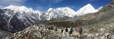
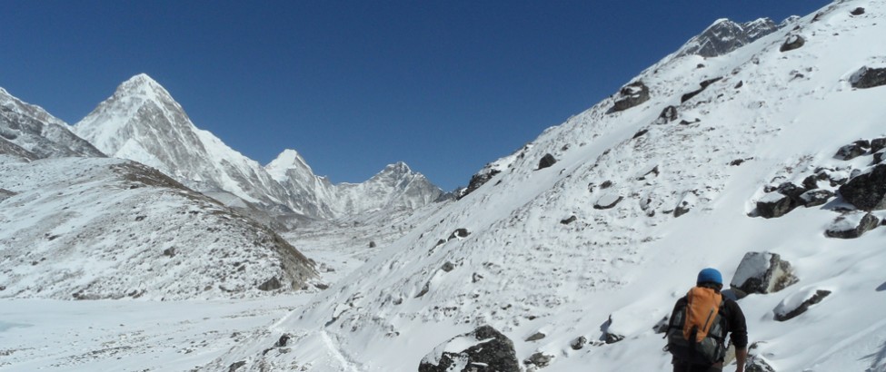
  • Day 14: Cross the Larkya La (5,135m/19842ft), trek to Bimtang (3,590m/11811ft), 7 - 8 hours walking. After an early start, we soon reach the ablation valley on the left side of the Larkya Glacier with impressive views of Cho Danda and Larkya Peak. We continue walking along glacial moraine and start making the gradual ascent to the summit of the Larkya pass. From the top, there is a panorama view of Himlung Himal, Cheo Himal, Kang Guru and Annapurna II. On the descent the trail follows the top of the moraine to the west and makes a set of steep, rough switchbacks as it crosses the moraine then descends more gently on snow to a grassy moraine. Depending on the conditions if icy then crampons and ice axe are advisable for the descent. The trail now becomes easier to follow and reaches a small meadow and spring at 4,080m/13382ft. The valley becomes wider as the trails heads down to a large meadow, past a mani wall and a small rest house that marks Bimthang. Stay overnight at teahouse.
     
  • Day 15: Trek to Tilje (2,300m) 5 - 6 hours walking. After crossing the pastures of Bimthang the trail drops to a glacial stream at the headwaters of the Dudh Khola, crosses a wooden bridge and descends into pine and rhododendron forest. Not far from here you reach Karche's fenced fields, then cross a landslide before making a steep climb to a ridge decorated with prayer flags before making a descent to the riverbank at Gho. The trail continues through fields and intermittent stands of rhododendron and oak to arrive at Tilje, a large Gurung village. Stay overnight at teahouse.
     
  • Day 16: Trek to Chamje (1,430m/4690ft), 5 - 6 hours walking.Exit the village through a stone arch, cross the Dudh Khola and follow along its embankment descending through scrub forest. The walls of the Marsyangdi Valley loom larger and finally the houses of Dharapani appear in the distance. Pass through Thonje via a wooden bridge and through a chorten-shaped arch, and Dharapani lies across a long suspension bridge over the Marsyangdi. The trail now follows the Annapurna Circuit route in reverse as you pass through the steepest part of the Marsyangdi gorge. Stay overnight at teahouse.
     
  • Day 17: Drive to Besisahar 2-3 hours and continue drive to Kathmandu.Today we drive down stream follow the Marshyangdi River passing though the Tal village by local transportation to Besisahar. At Besisahar the car will waiting you to pick you up and continue drive to Kathmandu. We back to Kathmandu and check in to hotel. Rest and relax at the hotel and overnight.
     
  • Day 18: Departure from Kathmandu.Today is free or last minute shopping for souvenirs or gift to your family, friends or relatives for you until your departure flight/drive or to commence any extra trips or activities you may have booked with us. If departing, you'll be transferred to the International Airport for your departure flight to your onwards destination.

                                      We wish you a wonderful Himalayan adventure with us!


Departure Dates

S.No. Start Date End Date Cost Status Book

Gallery

Reviews
All Reviews